DAMS & HYDRO
Safeguarding critical infrastructure by monitoring hidden land movement in remote terrain

Dams and Hydroelectric stations face a range of dynamic challenges, from fluctuating water pressure and seasonal changes to geological shifts, all of which can impact the structural integrity of these critical infrastructures. Traditional monitoring methods often fall short in providing the precision and responsiveness needed to address these complexities.
Kurloo’s GNSS technology offers highly accurate, near real-time monitoring of ground movement and structural shifts in dams and hydroelectric stations. By delivering continuous data, Kurloo enables engineers and operators to detect early signs of instability, allowing for proactive measures before issues escalate into significant problems.
Kurloo is proud to be working alongside Hydro Tasmania, monitoring the stability of these vital structures. Kurloo is also being used for satellite-derived in-land water topography mapping (sponsored by SmartSat CRC) at the Googong dam. These collaborations underscore Kurloo’s capability to support large-scale, high-stakes infrastructure projects.
In addition to enhancing safety, Kurloo’s system reduces the need for frequent, costly on-site inspections, which are often hazardous in remote or challenging environments. Operators can focus on ensuring the long-term stability of these assets, mitigating the risk of structural failures, flooding, or operational disruptions, all while safeguarding against potential environmental and economic impacts.
Dams & Hydroelectric applications
• Tailing Dams
• Levees
• Embankments
• Stabilisation
• Settlement
• Pipelines

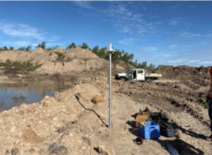
Dams & Hydro case study: Tailings Dam at Dawson’s Mine
To continue to conduct mining activities adjacent to the tailings dam, Kurloo was used to gather baseline data to serve as an early warning system against slope failure.
Our clients in Dams & Hydro


